
Watch for tropical cyclone formation continues in the Bay of Bengal.
But model projections now point to a scenario where the likely cyclone may begin to weaken over the waters ahead of making landfall around Chennai an adjoining south coastal Andhra Pradesh coast.
NUMBERED CYCLONE
This is because of the proximity with land as the system, now numbered as ‘03B’ by global models (‘numbering’ of a cyclone is the penultimate step before naming it) tracks west and then west-southwest.
A ‘numbered tropical cyclone’ is equivalent in status to a deep depression in India Meteorological Department parlance.
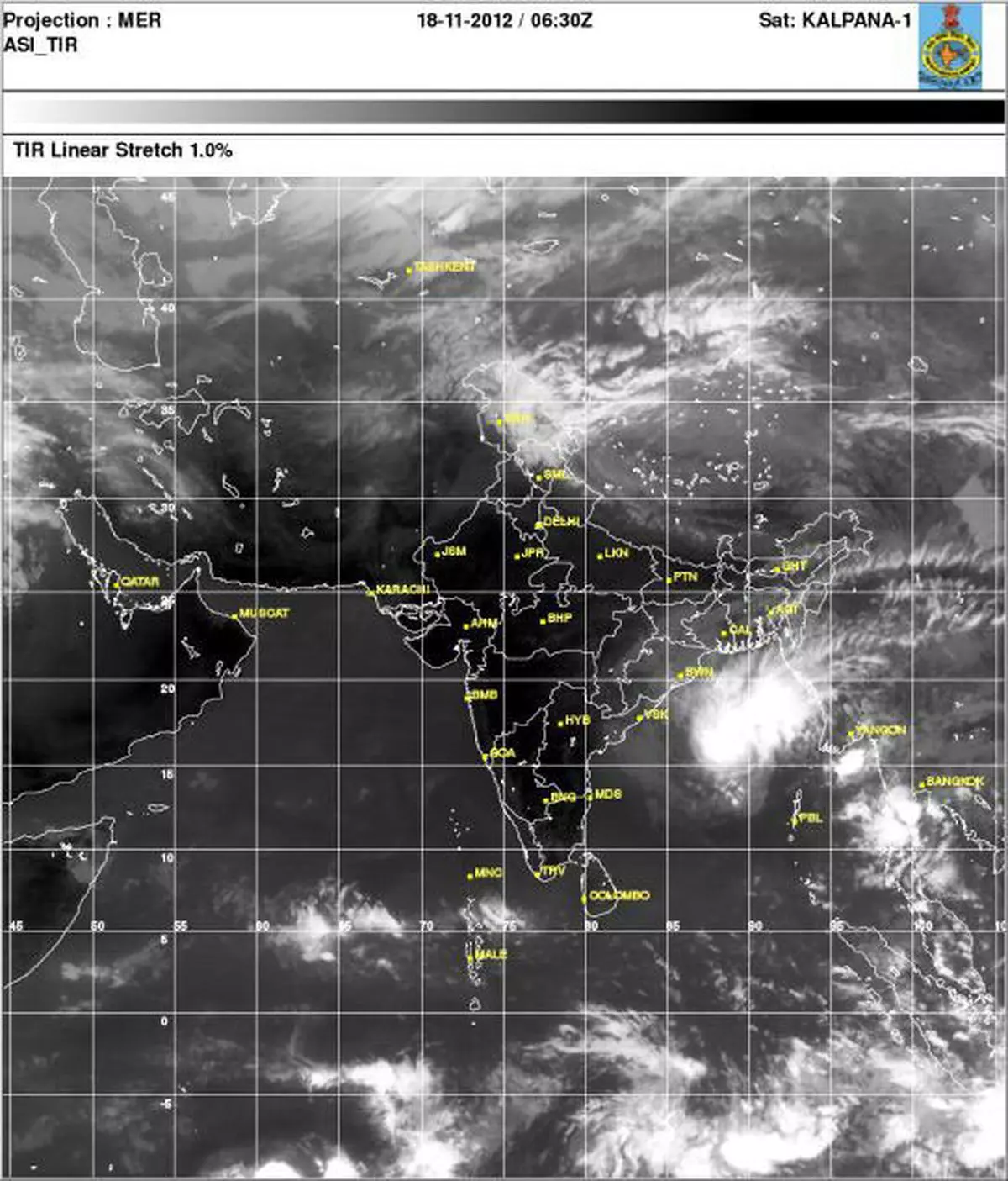
Earlier today, the deep depression was located over East-central Bay of Bengal, 950 km East-northeast of Chennai, 600 km East-southeast of Visakahapatnam and 520 km Southeast of Paradip.
It has since become stationary around these coordinates, nearest to Paradip as it would appear from the Eastern seaboard.
CYCLONE STATUS
The system would intensify into a cyclonic storm, to be called ‘Mahasen’ as per protocol, but would initially track west-northwestwards towards further north of Paradip.
After 12 hours, it would shift track towards west-southward with a slight edge to be moving largely west over coastal waters of the Bay of Bengal.
While doing so, the likely cyclonic storm may undergo weakening because of entrainment of dry continental air into the storm centre, global models said.
MAY WEAKEN
The storm could likely lose cyclone status as it prepares for a landfall around Chennai and adjoining south coastal Andhra Pradesh over the next three days (likely by Thursday).
Rain or thundershowers at one or two places over coastal Andhra Pradesh, south Tamil Nadu and south Kerala during next two days, which may scale up thereafter.
![]() Comments
Comments


Comments
Comments have to be in English, and in full sentences. They cannot be abusive or personal. Please abide by our community guidelines for posting your comments.
We have migrated to a new commenting platform. If you are already a registered user of TheHindu Businessline and logged in, you may continue to engage with our articles. If you do not have an account please register and login to post comments. Users can access their older comments by logging into their accounts on Vuukle.