A fresh western disturbance likely affecting the hills from Tuesday (April 12) night after a break will put a cap on the heating trend and bring a breather to North-West India, though most parts may continue to witness sizzling hot conditions during the intervening period, i.e. today and tomorrow (Sunday and Monday).
Maximum (day) temperatures are likely to fall by 2-3°C over most parts of North-West India from Monday to Thursday before top heat returns later during the week, India Meteorological Deparment (IMD) indicated on Sunday morning.
Heat wave to severe heat wave
So heat wave to severe heat wave conditions may continue to rule over most parts today (Sunday) of North-West India; many parts tomorrow (Monday) and in some parts from Tuesday to Thursday over West Rajasthan, the IMD outlook said.
Heat wave to severe heat wave conditions may spread across many parts of East Rajasthan today; over some parts tomorrow; and isolated pockets from Tuesday to Thursday. Similar conditions may prevail over parts of Punjab, Haryana and Delhi today and tomorrow.
Spread to Central India

Thunderstorms, lightning and rain will grow further to Coastal Karnataka and most parts of Tamil Nadu by Thursday.
These conditions may extend to parts over West Uttar Pradesh and West Madhya Pradesh (Central India) today. Some parts of West Madhya Pradesh too are likely to witness heat wave conditions from tomorrow to Thursday, the IMD said.
Other regions expected to come under the hot spell are East Madhya Pradesh, West Uttar Pradesh, Chhattisgarh and West Vidarbha (next five days); isolated pockets of Jharkhand (today); East Uttar Pradesh and Himachal Pradesh (today and tomorrow); and Punjab, Haryana and Delhi from Tuesday to Thursday.
Dust-raising winds
The western disturbance will bring light/moderate isolated/scattered rainfall to the Western Himalayas from Tuesday to Thursday. Rajasthan may get walloped by dust-raising winds (20-30 kmph) on Monday and Tuesday which will help bring down the top heat. Strong surface winds (25-35 kmph) may lash South-West Uttar Pradesh also.
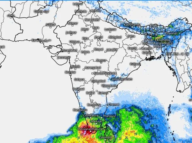
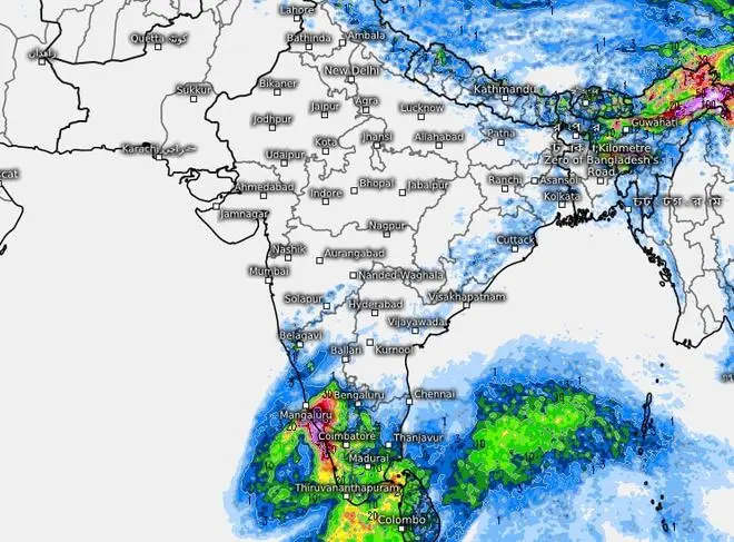
Meanwhile, seasonally volatile weather marked by thunderstorms, lightning and showers will entrench over parts of East and North-East India, and the South Peninsula as helpful circulations and troughs/wind discontinuity provide the trigger.

Projections for the weekend shows thundershower regime further entrenching over South and East-North-East linked by a narrow corridor along the East Coast
Thunderstorms elsewhere
The IMD has predicted fairly widespread to widespread rain, thunderstorms and lightning over the Sub-Himalayan West Bengal and Sikkim, Arunachal Pradesh, Assam-Meghalaya while it will be isolated to scattered over Nagaland, Manipur, Mizoram and Tripura during the next five days.
The trough/wind discontinuity has shifted alignment to Marathawada and runs down to South Interior Karnataka across North Interior Karnataka. The erstwhile cyclonic circulation over South-East Bay of Bengal has crawled to the West to lie near Sri Lanka this morning. Earlier projections of a low-pressure area building here have been withdrawn for now.
These atmospheric features will combine to sustain heavy rainfall over Kerala and along the ghat regions of Tamil Nadu today. The IMD has warned of squally weather (wind speeds of 40-50 kmph gusting to 60 kmph) over the Gulf of Mannar, Comorin area and the South-West Bay today. Fishermen are advised not to venture into these areas.


Comments
Comments have to be in English, and in full sentences. They cannot be abusive or personal. Please abide by our community guidelines for posting your comments.
We have migrated to a new commenting platform. If you are already a registered user of TheHindu Businessline and logged in, you may continue to engage with our articles. If you do not have an account please register and login to post comments. Users can access their older comments by logging into their accounts on Vuukle.