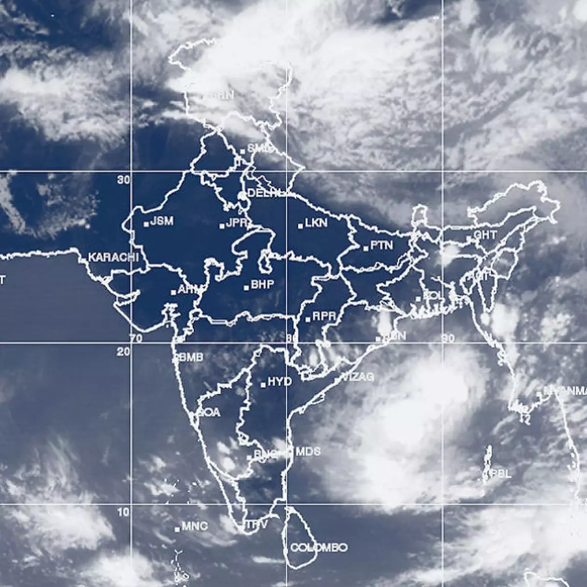
Wednesday’s monsoon depression was parked over east-central Bay of Bengal without intensifying until Thursday evening. India Met Department has taken off alert for intensification of the system.
Global models continued their watch for signs of intensification since the waters are still very warm over the north-east quadrant of the basin.
Global models, however, said that the shear was being offset by the ventilation at the top through which the storm breathes out and sustains life.
Most models now expect the depression to play around the Myanmar-Bangladesh coast and back out into east-central Bay and turn itself around to put India’s eastern coast in line of sight.
Western disturbance An arc of geography stretching along West Bengal-Odisha-coastal Andhra Pradesh could be the landfall point. Opposing winds from prevailing western disturbances too will have a say on where landfall happens.
In fact, the IMD traced a fresh western disturbance reading to cross the Jammu and Kashmir border into north-west India and move further east during the next two days.
Model forecasts also indicate that the east Bay of Bengal around Andaman Sea will come back to life again in a week’s time with the formation of a fresh low-pressure area.
This system is expected to spark activity in south-east Arabian Sea off India’s West coast. Early indications are that the system may head towards the open sea, away from the coast.
Onset scenario Models indicate this system might bring the monsoon over Kerala. By then, seasonal rains would also have announced their arrival over north-east India.
On Thursday, seasonal heat wave continued to be cast away from northwest and concentrated to the east over east Uttar Pradesh, Bihar, West Bengal, Jharkhand, Chhattisgarh, east Madhya Pradesh and Odisha.
Isolated rain or thundershowers would lash the plains of north-west India where, during this time of the year where ‘top heat’ would normally reside.
The Met indicated that thundershowers may start breaking out over extreme south from the weekend in what could be the build-up to the onset of the monsoon over mainland.
