For a better experience, Read this story in our App
TO ENJOY ADDITIONAL BENEFITS
Connect With Us

Get BusinessLine apps on
An anticipated low-pressure area has formed over north-west Bay of Bengal and adjoining coastal areas of Odisha and West Bengal coasts, India Meteorological Department (IMD) said this (Thursday) afternoon. This has taken the monsoon to further parts of Rajasthan, Punjab and Haryana.
Genesis of the ‘low’ was backdated to earlier in the morning, and it lay spreadeagled over the Bay waters and adjoining coasts by afternoon. It is likely to move in a typical west-northwest track across plains of West Bengal, Jharkhand and Chhattisgarh, just as the weatherman would have wished.
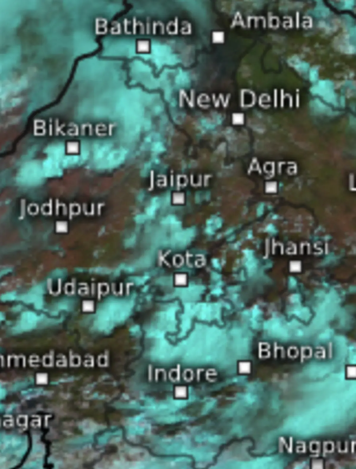
The northern limit of the monsoon moved in a decidedly painfully slow fashion to Jaisalmer, Bikaner, Jhunjhunu, Bharatpur, Rampur, Sonipat and Anupnagar. The national capital will have to wait a little longer for the monsoon. According to the IMD, the seasonal rainfall will extend to the sliver of land still left this part of North-West India, including Delhi, and progressively the rest of the country, over next 3-4 days.
This area also includes a narrow corridor across West Uttar Pradesh, Delhi, Haryana, Chandigarh and north and north-west Rajasthan, where winds appeared to lag and was devoid of clouds. The normal date of arrival of monsoon for Delhi is June 30, and coverage of entire country is July 8. Both these milestones are likely to be achieved variously ahead of time, depending on how the low-pressure area chooses to behave.
The ‘low’ had formed at a location proved suitably lower on East Coast to ignite the monsoon afresh farther away to the south-west over Kerala and Mahe overnight on Thursday morning, translating into extremely heavy rain at isolated places.
Heavy to very heavy rain lashed parts of rest of the southern state and elsewhere over the rest of the country across Odisha, Jammu-Kashmir-Ladakh; Madhya Pradesh, east Gujarat; Vidarbha; Telangana; Tamil Nadu, Puducherry and Karaikal; Coastal Karnataka and South Interior Karnataka.
It more or less resembled the spectacular phase with which the monsoon unfolded earlier than normal over the South Peninsula on May 24. Rainfall for the country as a whole further consolidated to +9.1 per cent on Wednesday, with major recoveries over East and North-East where rain deficit is reduced to -11.9 per cent and South Peninsula returning to positive side (+1.1 per cent). North-West India (+38.7 per cent) and Central India (+22.4 per cent) have logged in huge surpluses so far.
The IMD had forecast that June might return above normal rainfall of +8 per cent, which is likely to be achieved. The 24 hours ending on Thursday morning also saw heavy rain being reported from Assam and Meghalaya; Jharkhand; Uttarakhand; Haryana-Chandigarh-Delhi; Punjab; Himachal Pradesh; East Rajasthan; East Madhya Pradesh; Madhya Maharashtra; Marathwada; Chhattisgarh and North Interior Karnataka.
Published on June 26, 2025


Comments
Comments have to be in English, and in full sentences. They cannot be abusive or personal. Please abide by our community guidelines for posting your comments.
We have migrated to a new commenting platform. If you are already a registered user of TheHindu Businessline and logged in, you may continue to engage with our articles. If you do not have an account please register and login to post comments. Users can access their older comments by logging into their accounts on Vuukle.