
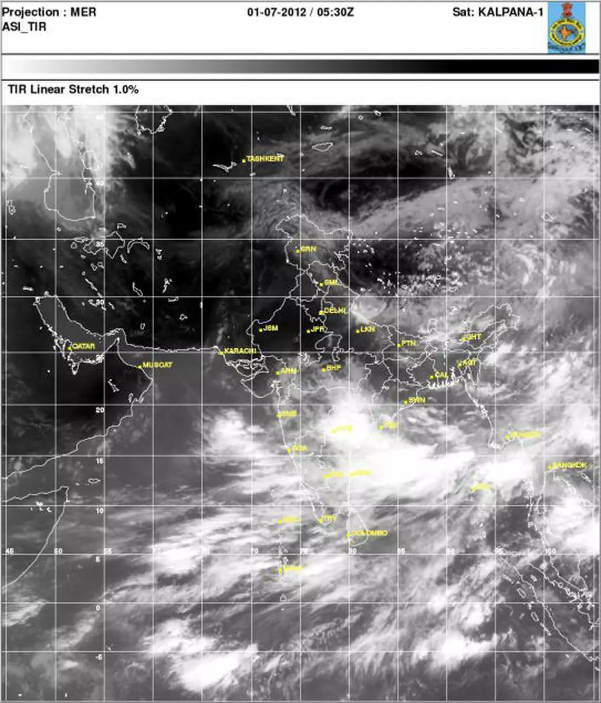
It’s July 1, and for almost an entire month after breaking over mainland India on June 5, the monsoon settings have hardly looked as best as they do this morning.
It features two ‘engines’ in the form of cyclonic circulations strategically located to either side of peninsular India.
HUMMING ENGINES
The engines are humming, but would need to pick up momentum, build and sustain roaring strength to be able to power the monsoon into the farming heartland.
Twin-engine monsoons have in the past underwritten the most effective rally into the cotton, oilseed and sugarcane farming areas in the plains of north and northwest India.
Often, they have interacted with western disturbances coming in from the northwest border and caused moderate to heavy rains in the region.
For now, India Meteorological Department has indicated enhanced rains for the peninsular regions for the next few days.
Its weather warning said heavy rainfall would lash Konkan, Goa, Madhya Maharashtra, coastal and north interior Karnataka, Telangana, coastal Andhra Pradesh and Orissa during next two days.
RAIN OUTLOOK
Extended outlook valid until July 8 said that rain or thundershowers are likely at many places along west coast, east and adjoining central India and the Northeastern States.
The IMD also saw increase in rainfall activity over northwest India during this period.
But here is international weather models begged to differ. They have pointed to chances of cyclone formation alert in the northwest Pacific during the week beginning July 8.
If this were to materialise, it could throw a spanner in the monsoon works, yet again.
![]() Comments
Comments
")


Comments
Comments have to be in English, and in full sentences. They cannot be abusive or personal. Please abide by our community guidelines for posting your comments.
We have migrated to a new commenting platform. If you are already a registered user of TheHindu Businessline and logged in, you may continue to engage with our articles. If you do not have an account please register and login to post comments. Users can access their older comments by logging into their accounts on Vuukle.