
The plains of North-West India have been witnessing ‘cold day’ to ‘severe cold conditions over the past couple of days as they slipped under a blanket of dense fog that prevents sunlight from penetrating the ground and traps cold air instead of capping day temperatures at 16 degrees Celsius or below.
India Meteorological Department (IMD) had extended a warning that these conditions would prevail over Punjab, Haryana, Chandigarh, Delhi, Uttar Pradesh, Uttarakhand, Rajasthan and West Madhya Pradesh on Monday as also over the East over East Madhya Pradesh and Bihar.
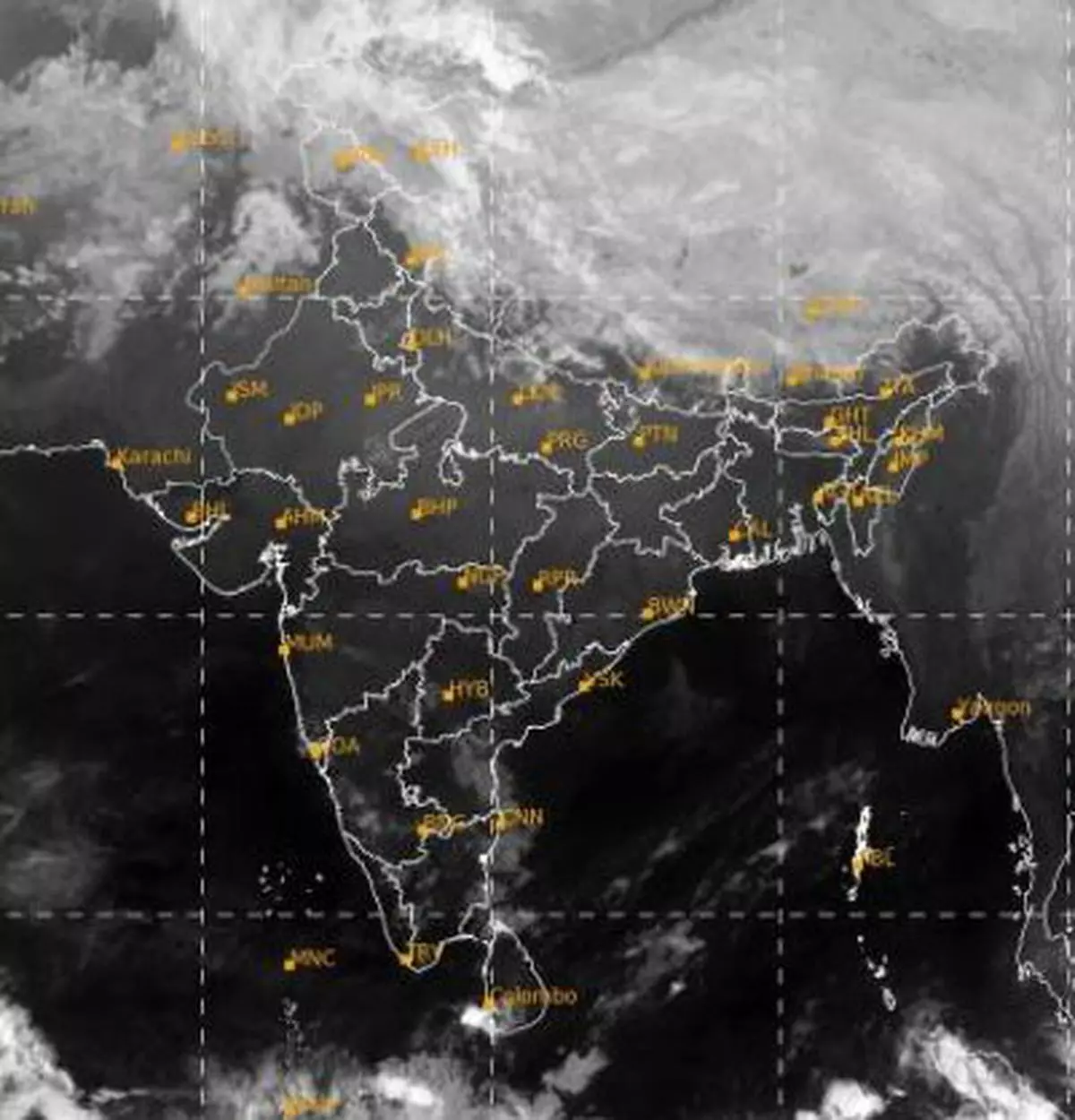
Dense fog across region
This was to be expected as dense to very dense fog would throw an envelope over most of the region, East Uttar Pradesh, West Madhya Pradesh and Rajasthan and dense fog over East Madhya Pradesh, Bihar, Odisha, West Bengal, Assam, Meghalaya and Nagaland, Manipur, Mizoram and Tripura.
As for Tuesday, the dense fog may linger over East Uttar Pradesh, Rajasthan, West Madhya Pradesh, Bihar, Odisha, West Bengal, Assam, Meghalaya, Nagaland, Manipur, Mizoram and Tripura.
The IMD expects that cold day conditions may persist over West Madhya Pradesh, Punjab, Haryana, Chandigarh, Delhi, Uttar Pradesh, Rajasthan, Bihar and East Madhya Pradesh.
Westerlies take a break
Dense fog and cold day conditions are generated as western disturbance activity breaks and allow frigid Arctic north-westerly winds to fill the plains. Moisture left behind by previous active disturbances gets cooled and converted into fog as the wind speeds also lag.
A set of western disturbances, a weak and strong one respectively from Tuesday and Friday, may bring about a change in these conditions, and noticeably so from Friday. Embedded moisture may once again bring back light to moderate rain and snowfall over the hills and plains of North-West India.
Fresh disturbances likely
The moisture and cloud embedded in the western disturbances will cause minimum (night) temperatures to rise by 2-4 degrees Celsius (as against cold day conditions currently) over most parts of North-West India during the next five days as clouds trap solar radiation back over the ground.
Meanwhile, the IMD has forecast some freak heavy rainfall over North Coastal Tamil Nadu and South Coastal Andhra Pradesh due to a weak trough along the East Coast. Thunderstorms accompanied by lightning is likely over South Coastal Andhra Pradesh and North Coastal Tamil Nadu.
![]() Comments
Comments

Comments
Comments have to be in English, and in full sentences. They cannot be abusive or personal. Please abide by our community guidelines for posting your comments.
We have migrated to a new commenting platform. If you are already a registered user of TheHindu Businessline and logged in, you may continue to engage with our articles. If you do not have an account please register and login to post comments. Users can access their older comments by logging into their accounts on Vuukle.